-
Specify
Row and Cross slopes, Cut/Fill Ratio
-
Field
Size: 100 Rows by 100 Columns, variable grid size.
-
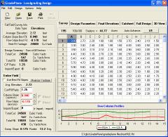
Survey
Data Entry in Rod Readings or Elevations
-
Convenient
spreadsheet for data entry and import data files
-
Plane
Method of Field Design
-
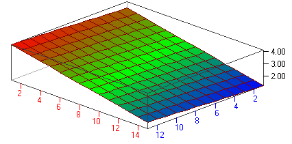
Automatic
Best Fit Design based on field Row and Cross slope trends and find
slopes that minimize cut yardage.
-
Take
advantage of natural field slopes and Design Fields with up to Seven
Sectors and blend (hinge) slopes at break lines
-
Import
yardage from outside the field or export yardage for construction
projects.
-
Force
design plane to a specified elevation
-
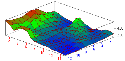
3D
Graphics view of designs and surveys
-
Multiple
Printed Maps: Cutsheet, Full Design Information, Survey and
Graphs.
-
Work
with a Full Field Design and Sector Design Simultaneously and compare
results
-
Check
Cut/Fill Ratios as work progresses.
-
Gradeplane now allows any station to be flagged as a
partial station
-
-
Survey directly into Gradeplane with MEI or
Laser Alignment Control Boxes
-